ALL MAPS DESIGNED BY MARY KING 2006
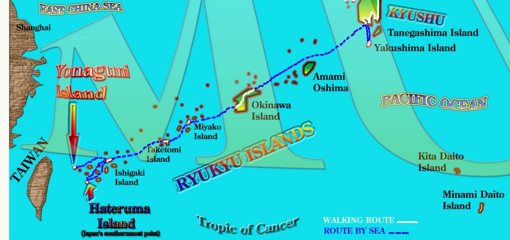
The last leg of our walk saw us walking from Motobu Port, at the north of the main Okinawa Island down to Shuri City, near Naha. From here, we then sailed to a number of Okinawa's Island. We touched down and walked around Miyako Island, Toyotomi Island, Ishigaki Island, Hateruma Island (Japan's southernmost inhabited island), and then finally reached the shores of Yonaguni Island.It is off the shores of Yonaguni Island that the mysterious underwater "ruins" lie. Some believe that these are the ruins of Mu, which is Asia's equivalent of Atlantis.
FOR ROUTE IN JAPANESE SEE HERE日本の地図

No comments:
Post a Comment