skip to main | skip to sidebar

Japan on Foot

A 4,600-mile "roving reporter" walk

Monday, May 15, 2006

MAP SHOWING OUR ROUTE: HOKKAIDO

READ LEG 1 OF OUR WALK: HOKKAIDO


ALL MAPS DESIGNED BY MARY KING 2006


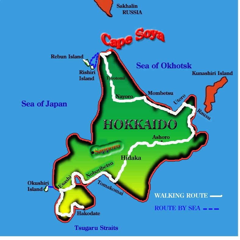
The first leg of our walk was through the island of Hokkaido, from Japan's northernmost point, Cape Soya. We spent about four months traipsing around Hokkaido, finishing at Hakodate, from where we sailed across the Tsugaru Straits to northern Honshu (Cape Oma, in Aomori Prefecture).


GOOGLE MAP OF JAPAN

FOR ROUTE IN JAPANESE SEE HERE 日本の地図

Posted by Picasa
Posted by Mary King/Radio Presenter & Multimedia Journalist at 9:29 pm

No comments:

Post a Comment

Newer Post Older Post Home
Subscribe to: Post Comments (Atom)

Blog Archive

  • ►  2014 (1)
    • ►  December (1)
  • ►  2011 (1)
    • ►  December (1)
  • ►  2010 (2)
    • ►  October (1)
    • ►  August (1)
  • ▼  2006 (20)
    • ►  July (1)
    • ▼  May (10)
      • No. 3: SHIKOKU ISLAND
      • PART 6: FINAL STEPS TO OKINAWA & MU
      • FINAL LEG THROUGH OKINAWA TO MU
      • SHIKOKU, CHUGOKU REGION & KYUSHU
      • AOMORI PREFECTURE TO WAKAYAMA PREFECTURE
      • MAP SHOWING OUR ROUTE: HOKKAIDO
      • AUTHOR BIOS
      • Part 5: KYUSHU
      • Okinawa shots
      • Girls on the road
    • ►  April (9)